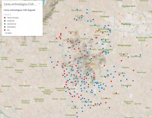
Archaeological sites extracted from the archaeological survey of Veneto Region.
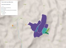
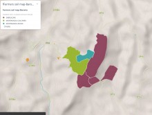
Past land use map of Baronia study area (Monti di Trapani) generated by the farmers based on their local knowledge.
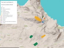
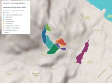
Past land use map of Balata di Baida study area (Monti di Trapani) generated by the farmers based on their local knowledge.
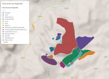
Past land use map of Angimbé study area (Monti di Trapani) generated by the farmers based on their local knowledge.
Soil map of Baronia study area (Monti di Trapani) generated by the farmers based on their local knowledge.
Soil map of Balata di Baida study area (Monti di Trapani) generated by the farmers based on their local knowledge.
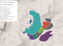
Soil map of Angimbé study area (Monti di Trapani) generated by the farmers based on their local knowledge.
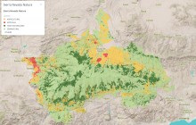
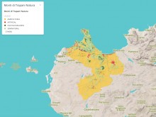
Naturalness map, with four categories: Agricultural, High Naturalness, Seminatural and Artificial.
This education digital resource has been put together by Julia Sarabia, Federica Benetti and Paolo Vedovetto, under the supervision of Alexandra Chavarría (UNIPD).
It is freely available on the iBooks Store (400MB - download over Wi-Fi).