
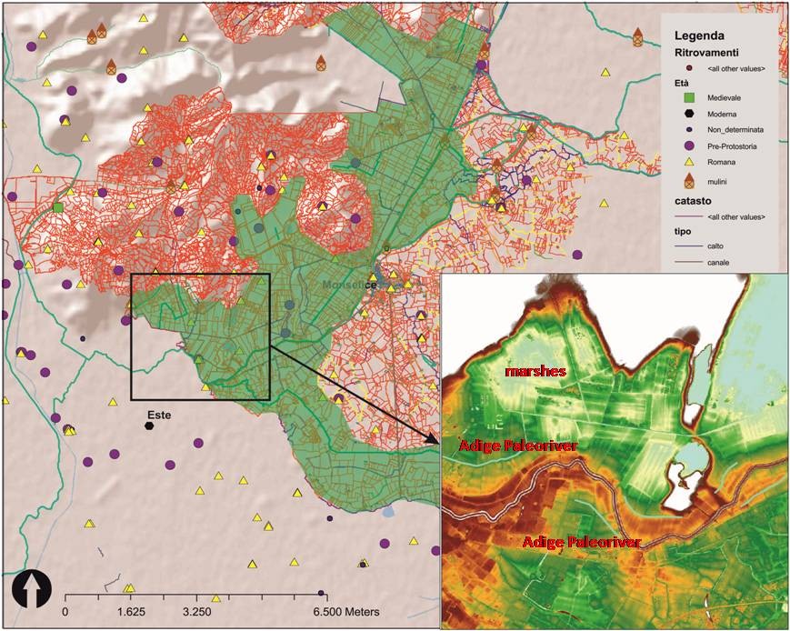
The Padua team has performed the recognition on the surface of all anomalies interpreted on raster images obtained by remote sensing (LiDAR, Radar, Aerial photographs). For instance, the historical photographs and LiDAR images, allowed to recognize traces of the paleo-riverbeds and their relation with the settlement patterns and the formation of agrarian landscapes, as we can see in Baone area (one of the sample areas chosen in the Euganean Hills for the reconstruction of land and water uses).
In this case, on the LiDAR of this area, after application of a visualization technique that highlights the micro-relief, we can see traces of a paleo-riverbed belonging to the river Adige, and areas of wetlands that have been drained in the sixteenth century and that do not currently exist. Also we can see how the plots and the roads follow this riverbed, so this is the principal element generating the surrounding landscape.
The image shows the photo interpretation of paleobeds at Rovolon, and GIS with the archaeological records and DTM-LiDAR of Baone area with paleoriver Adige and wetlands areas.