
During 2015, a GIS map platform was designed, which is entirely dedicated to the research of MEMOLA project in the Upper Vjosa Valley. It represents a complex and versatile structure, currently holding a variety of information, such as the topographic elements, infrastructure, hydro networks, aerial photographs, archaeological data, and etc.
Apart from the generation of thematic maps regarding various aspects of the study, such as archaeology, irrigation systems, land parcel characteristics and etc., DEM (Digital Elevation Models) have been created, which enable the terrain surface analyzes.
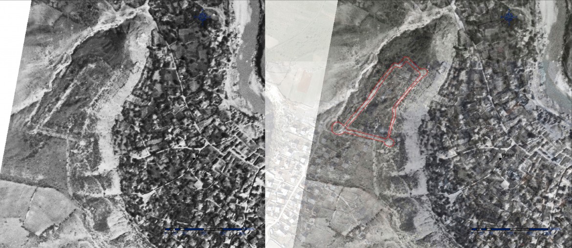
Also, GIS processing of aerial photographs, (captured at different periods) enabled a remote land survey of the study area, in order to observe the long term historical changes of the landscape. Thus, analyzes of the aerial photographs of 1937, obtained from the archive of the Instituto Geografico Militare di Firenze (Italy), made possible the location of the castle of Bolëngë (Përmet), a monument which was known in the historical sources but had been impossible to be detected in the nowadays landscape.