
Project
You are here
The project is an interdisciplinary approach to cultural landscapes of Mediterranean mountainous areas, taking as a central axis the historical study of two natural resources essential to generate agro-systems: water and soil. The study focuses on four areas: Sierra Nevada (Spain), Monti di Trapani (Italy), Colli Euganei (Italy) and Vjosa Valley(Albania).
Landscapes and their structure are strongly conditioned by the need to ensure the livelihood of rural communities over time. Essentially they are the spatial representation of production and reproduction strategies of societies over time. Understanding them necessarily requires knowledge of the historical processes that have led to specific relationships with nature: mainly extraction and use of resources. These uses have largely shaped the medium, generating not only its shape, but also the culture that makes possible its management and maintenance.
The various exploitation strategies have resulted in different landscapes and forms of cultural expression throughout Europe and the Mediterranean, but have also produced very important common areas. Agro-systems represent one of their greatest expressions. Agricultural traditions and the different ways of exploiting natural resources including management over time are crucial for conservation of the landscape and its ability to adapt to current global changes: globalisation and agrarian industrialisation, loss of peasant knowledge, loss of rural population and climate change.
Conservation can be achieved through the exploitation of this heritage to generate environmental and cultural conservation strategies for sustainable development in rural areas; with the aim of protecting this cultural heritage and, at the same time, increasing and transmitting knowledge about it in order to benefit the local and wider European society.
Work Packages:
WP1: Historical-archaeological study of Sierra Nevada
- Hydraulic survey, consisting of the topographic survey of the irrigation systems of Sierra Nevada and its environment: UGR.
- Archaeological excavation in specific sites strongly related to the performance of the productive activities: UGR, USHEFF. Archeobotanical samples: CSIC.
- Archaeological Survey: UGR, USHEFF.
- Ethnographic study of some rural communities in the area: irrigators’ communities, specific areas of grazing, mountain and dry-land crops: UGR.
- Analysis of the materials obtained from the archaeological sites: pottery and archaeobotanical indicators that will serve to perform mineralogical and chemical analysis for the reconstruction of paleosoils and to obtain chronologies and relative dates: UGR; Archaeobotanical analysis: CSIC; Paleosoil analysis: UNIPD.
- Analysis of the area by remote sensing (LIDAR), for the identification of grassland areas, old areas of irrigated crops, rainfed, abandoned agricultural terraces, parcels, irrigation channels and also potential archaeological sites still unknown: UNIPD, UGR.
- Comparative analysis of historical and current parcels for the reconstruction of the old fields boundary pattern and the changes that have been occurring over time: UNIPD, UGR.
- Archival and bibliographical data collection: UGR.
- GIS Cartography of archaeological sites, land uses and water uses: UGR.
WP2: Historical-archaeological study of Colli Euganei
- Analysis of the area by remote sensing (LIDAR), for the identification of grassland areas, old areas of irrigated crops, rainfed, abandoned agricultural terraces, parcels, irrigation channels and also potential archaeological sites still unknown: UNIPD, UGR.
- Hydraulic survey: land and hydro recourses use, focusing on data collection for identification and utilization, along with the historical methods of construction of irrigation systems, land enrichment, production and administration. The survey also includes the location of the natural resources which have historically served the people of the area for subsistence, including local sources, traditional grazing areas, terraced fields, etc.: UGR, UNIPD.
- Archaeological excavation in specific sites already localised and strongly related to the performance of the productive activities: UNIPD; Archeobotanical samples: CSIC.
- Archaeological Survey - UNIPD.
- Ethnographic study of some rural communities in the area: specific areas of grazing, mountain and dryland crops – UNIPD.
- Analysis of the materials obtained in the archaeological sites: pottery and archaeobotanical indicators that will serve to perform mineralogical and chemical analysis for the reconstruction of paleosoils and to obtain chronologies and relative dates: UNIPD; Archaeobotanical analysis: CSIC.
- Comparative analysis of historical and current parcels for the reconstruction of the old fields boundary pattern and the changes that have been occurring over time: UNIPD.
- Archival and bibliographical data collection: UNIPD.
- GIS Cartography of archaeological sites, land uses and water uses: UNIPD.
WP3: Historical-archaeological study of Vjosa Valley
- 1. Field surveys – which will involve a wide territory on both sides of the Upper Vjosa Valley, and will aim at collecting a variety of data type, including archaeological artifacts, monumental ruins, geo-morphological elements, land and soil composition, hydrology, and other information regarding the cultural landscape of the area. The surveys will consist of:
- Archaeological field survey, which will focus on the identification and documentation of archaeological sites, in order to reveal ancient settlements of the valley and their characteristics throughout the history: CeRPHAAL.
- Ethno-archaeological survey, intending to collect and analyse data about the population activities related to historical use and management of land and water resources. A specific focus of the survey will be the assessment of Vlah ethno cultural group, an ancient pastoral nomadic community still living in the area, aiming to record their cultural values, presently in danger of extinction, and also to produce comparative models in order to depict ancient transhumance activities in the valley. Another aspect will be the study of the traditional ways of living of the rural communities of the area, as potential recourses aiding in the local tourism development: UGR, CeRPHAAL.
- Geo-morphological and geographical field study aiming to identify and document detailed data about the geological formation of the territory, natural hydro sources, land composition and use (agricultural or grazing areas) including its natural suitability related to agro-pastoral activities: CeRPHAAL.
- Hydrological survey, focusing on collecting data related to hydro-sources, their identification and actual utilization, along with the historical methods of construction of irrigation systems, land enrichment, production and administration: UGR, CeRPHAAL.
- Analysis of the area by remote sensing (LIDAR), for the identification of grassland areas, old areas of irrigated crops, rainfed, abandoned agricultural terraces, parcels, irrigation channels and also potential archaeological sites still unknown: UNIPD, UGR, CeRPHAAL.
- Stratigraphical test pits – consisting on archaeological excavation, undertaken in specific sites (already localized or that will be identified during the archaeological field survey) strongly related to the performance of the productive activities: CeRPHAAL, USHEFF; Archeobotanical samples: CSIC.
- Analysis of the materials obtained from the archaeological sites: pottery and archaeobotanical indicators that will serve to perform mineralogical and chemical analysis for the reconstruction of paleosoils and to obtain chronologies and relative dates: CeRPHAAL; Archaeobotanical analysis: CSIC; Paleosoil analysis: UNIPD.
- Archival and bibliographical data collection regarding the historic land use and explotation, forest, pastures and meadows, flora, fauna, settlement, populations, etc., to enhance the results of field research and support the historical landscape interpretation of the valley: CeRPHAAL.
- GIS Cartography of archaeological sites, land uses and water uses: CeRPHAAL.
WP4: Historical-archaeological study of Monti di Trapani
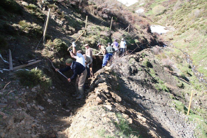
- Hydraulic survey, consisting of the topographic survey of the irrigation systems of Trapani Mountains and its environment, the examination also includes the location of the natural resources which have historically served the people of the area for subsistence, including local sources, traditional grazing areas, terraced fields, etc.: UGR.
- Archaeological excavation in specific sites already localised, strongly related to the performance of the productive activities: Pizzo Monaco, probably a fortified granary (agadir) and associated farm barn (alquería) at the foot of the mountain, near the source of Baida, form an irrigated area disappeared after the Norman conquest and expulsion of the Muslim population in Swabian era: USHEFF, UGR; Archaeobotanical samples: CSIC.
- Archaeological Survey: USHEFF.
- Ethnographic study of some rural communities in the area: irrigation communities, specific areas of grazing, mountain and dryland crops: USHEFF.
- Analysis of the materials obtained in the archaeological sites: pottery and archaeobotanical indicators that will serve to perform mineralogical and chemical analysis for the reconstruction of paleosoils and to obtain chronologies and relative dates: USHEFF, UGR; Archaeobotanical analysis: CSIC.
- GIS Cartography of archaeological sites, land uses and water uses: USHEFF.
WP5: Analysis of potential current and historical land uses
- Conduct a diachronic analysis of the natural and cultivated vegetation of the different rural areas to assess incurred changes and compare each other, through three steps:
- Analysis and mapping of Actual Vegetation (Cultural Landscape) of each site: UNIPA.
- Analysis and mapping of Potential Natural Vegetation to hypothesize the vegetation pattern not altered by humans (Natural Landscape): UNIPA.
- Analysis and mapping of Landscape Conservation (Grade of naturalness): UNIPA.
- Archaeological Land Evaluation, in order to assess Landscape suitability for a series of potential land uses, which a peasant community might have practiced: UNIPA.
- Pedological survey in order to identify and evaluate paleosoils and its formation process: UNIPA.
- Archaeobotanical analysis in order to depict the ancient landscape and verify the land evaluation process: CSIC.
- Development of an historic land use distribution model based on data from the archaeological sites with the aim of estimating the total area needed by the population in the regions (current and historical): UCO.
- Development of a water use efficiency model to assess the historical patterns of agricultural water use: UCO.
- Estimation of agricultural productivity and analysis of the resource use efficiency applying calibrated and validated models for the study sites: UCO.
WP6: Sustainability studies and ecosystem services
- Assessment of changes in land use and management from an historical perspective and with a specific focus on the recent changes induced by globalization and economic crises. Identification of limiting factors and of the drivers of changes via development of alternative scenarios: UCO.
- Comparative analysis (historical vs. current) of water management under scarcity and assessment of how societies dealt with risks and uncertainty in the four locations: UCO.
- Biodiversity assessment of old varieties cultivated in traditional agrarian systems: UNIPA.
- Biodiversity assessment of endemic and rare plants growing in traditional agrarian systems: UNIPA.
- Assessment of ecosystem services using a simulation model in the study areas, including the traditional agrarian (agriculture and livestock) systems in relation of water and land use. – UCO.
- Sustainability assessment of resource use and management (water and land) in the study areas using the MESMIS framework. Derivation of sustainability indicators tailored to the Mediterranean mountain ecosystems with an historical perspective. – UCO.
- Derivation of agroecosystem management rules and alternative practices for Mediterranean mountain environment, ensuring the environmental integrity, economic resilience, social well-being, and good governance: UCO.
WP7: Outreach activities
The project will carry out a series of dissemination activities as follow:
- Corporate website: we will create a public website to publish all the results in different formats, like post (results by countries, comparative analysis, etc.), multimedia, interactive maps, image galleries, etc.: EAP (WP8 Corporate website coordinator).
- Articles on scientific journals: the project results will be published in the leading scientific journals with impact in the disciplines involved (environment, archaeology, agriculture, etc.): UGR & ARQUEO (WP1 Sierra Nevada publications); UNIPD (WP2 Colli Euganei publications); CeRPHAAL (WP3 Upper Vjosa Valley publications); USHEFF (WP4 Trapani mountains publications); UNIPA (WP5 Historical Land Uses publications about the areas studied); UCO (WP5 Sustainability and ecosystems publications about the areas studied); CSIC (archaeobotanical publications about the areas studied).
- Monographs: at the end of the project a monograph will be published for each territory involved in the historical, archaeological and environmental study. The monographs will have a scientific approach, but also intended for a broad audience interested in the subject and not necessarily specialized. They will be published in electronic format (e-book) and downloadable for free through the corporate website: UGR & ARQUEO (Sierra Nevada monograph coordinator); UNIPD (Collei Euganei coordinator; CeRPHAAL (Upper Vjosa Valley monograph coordinator); USHEFF (Trapani Mountains monograph coordinator); EAP (monograph publications and e-book format).
- Educative resources, for primary and high schools, for each of the four analysed landscapes, available through the project website. - UGR & ARQUEO (educative resources about Sierra Nevada); UNIPD (educative resources about Colli Euganei); CeRPHAAL (educative resources about Upper Vjosa Valley); USHEFF (educative resources about Trapani Mountains); EAP (educative resources publication e-Book format).
- Workshops with local schools, including field activities, inquests to young people and intergenerational meetings: UGR, ARQUEO & CeRPHAAL.
- Scientific conferences: we will perform an annual conference focused on the topic of each groups/territories, in the following order:
- Granada: “Gestión Histórica del Agua en Zonas de Alta Montaña", celebrated on February the 10th and 11th, 2014. UNESCO AND (coordinador) ARQUEO & UGR
- Padova: "Archeologia del paesaggio e saperi tradizionali", with several days of conferences and workshops: UNIPD.
- Përmet: “Cultural Landscapes as an engine of economic and social development": CeRPHAAL (koordinator) & USHEFF
- Córdoba and Palermo: "Agricultura sostenible y paisajes culturales. Usos del suelo históricos: agricultura, vegetación y paisaje": UCO (coordinator).
- Conference on the final results of the project - UGR (coordinator); UNIPD, UCO, UNIPA, USHEFF, EAP, ARQUEO, CeRPHAAL and UNESCO-AND.
- Exhibitions organized locally and with specific resources aimed at different audiences and depending on the characteristics of the relative.
- Results’ impact rate: we will measures the impact factor of the outreach activities in two ways:
- Quantitative level: 1. corporate website visitors numbers; 2. number of followers through Facebook, Twitter and Google+; 3. number of workshop attendees; 4. number of conferences and seminars attendees: EAP (transmission quality coordinator & data analysis).
- Qualitative level: we will carry out satisfaction surveys, on-line (i.e. using Google web-forms) or on paper format, through: workshops attendees; social media followers (Facebook, etc.): EAP (transmission quality coordinator), UGR & ARQUEO (quality data analysis).
WP8: Internal management work
The internal management work activities will be organized as follow:
- Protocols of work management: compilation, analysis (standardization format) and diffusion through the private part of the corporate website (UGR):
- Protocol for data collection of irrigation systems: UGR-UCO.
- Protocol for soils sampling: UCO-UNIPD.
- Protocol for arqueo-biological samples: CSIC-UCO
- Protocol for land evaluation: UGR-UCO-UNIPA-UNIPD.
- Protocol for sites documentation during the survey: UNISHEFF-UNIPD-UGR-CeRPHAAL.
- Protocol for DBMS/Georepository data entry: EAP-UGR.
- Compiling internal annual reports about activities and management: UGR.
- Compiling summary of annual activities final reports for the EC: UGR
- Compiling public annual reports and diffusion through the public part of the corporate website: UGR, EAP.
- Private Corporate website development (field data and management): the project website will have a private area to access the on-line DBMS and the management oriented sections such as calendar for events and due dates, Newsletters for “one to many” occasional information, administration documents and Reports: EAP.
- Private Corporate website information updating - EAP, UGR, UNIPD, UCO, UNIPA, USHEFF, ARQUEO, CSIC, CeRPHAAL, UNESCO-AND.
- Public Corporate website development and management: EAP.
- Public Corporate website information updating: EAP, UGR.
- Webinars for information sharing and coordination will be performed periodically: EAP, UGR, UNIPD, UCO, UNIPA, USHEFF, ARQUEO, CSIC, CeRPHAAL, UNESCO-AND.
- Internal periodical workshops will be used for in-house meetings for skills interchange and training: EAP, UGR, UNIPD, UCO, UNIPA, USHEFF, ARQUEO, CSIC, CeRPHAAL.
WP9: Socio-economic impact
- Thematic seminars will be held in each study areas
- Specific seminars and meetings with professionals, companies and organizations related to agricultural and livestock production: ARQUEO, UGR, UNIPD, CeRPHAAL, USHEFF, UCO, UNIPA.
- Specific seminars and meetings with local and regional policy makers in the areas of agriculture, territorial planning, rural development, environment and/or cultural heritage: ARQUEO, UGR, UNIPD, CeRPHAAL, USHEFF, UCO, UNIPA.
- Meeting with European policy makers and representatives in Brussels in the areas of agriculture, heritage, sustainable development, rural development, environment (specifically Water Directive Framework): UGR, UNIPD, USHEFF, UCO, UNIPA, CeRPHAAL.
- Cultural thematic routes: historical water & land use trails and traditional skills & know-how pathways identified in the study areas and available as a downloadable resource on the website and proposed to the local relevant administrations for implementation. The routes will mainly use data recovered during the field activities combined with local hotspot and connected with existing cultural routes: EAP, ARQUEO, UGR, UNIPD, USHEFF, CeRPHAAL.
- Direct participation in UNESCO heritage proposal for the Alpujarra (Sierra Nevada, Granada): UNESCO-AND, UGR
- Analysis of the role and impact of the Water Framework Directive and EU Water Blueprint strategy on the current uses of water in the studied agro-ecosystems, and lessons learned from the past that may be useful to feedback into current and future EU policies: UCO
- Development of a set of criteria for the design of policies leading to the sustainable development of Mediterranean mountain environments: UCO
- Workshop with policymakers to present and discuss the sets of criteria for the design and implementation of policies: UCO