This policy brief summarises the MEMOLA project findings regarding the role agrobiodiversity has in reactivating Mediterranean agricultural systems. Traditional varieties are the best ambassadors of the landscape in which they are cultivated.
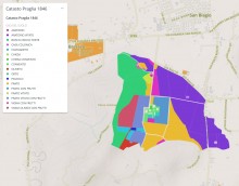
Uso storico del suolo come registrato nel catasto austriaco, 1846.
Il campo pertichen ella tavola degli attributi si riferisce alla siperficie della parcella. Una pertica equivale a 650 m².
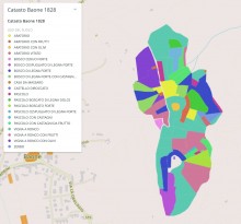
Uso storico del suolo come registrato nel catasto napoleonico, 1828.
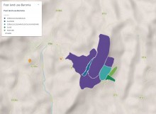
Past land use map of Baronia study area (Monti di Trapani) generated by the farmers based on their local knowledge.
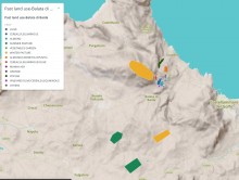
Past land use map of Balata di Baida study area (Monti di Trapani) generated by the farmers based on their local knowledge.
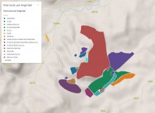
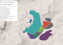
Past land use map of Angimbé study area (Monti di Trapani) generated by the farmers based on their local knowledge.
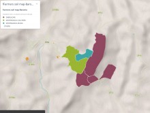
Soil map of Baronia study area (Monti di Trapani) generated by the farmers based on their local knowledge.
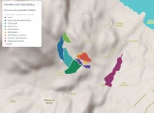
Soil map of Balata di Baida study area (Monti di Trapani) generated by the farmers based on their local knowledge.
Soil map of Angimbé study area (Monti di Trapani) generated by the farmers based on their local knowledge.